
Ephesus confuses first-time visitors for one simple reason: it has two entrances, and the difference between them is a hillside. Understand the map below and you understand the whole strategy of a good visit.
How to read the city
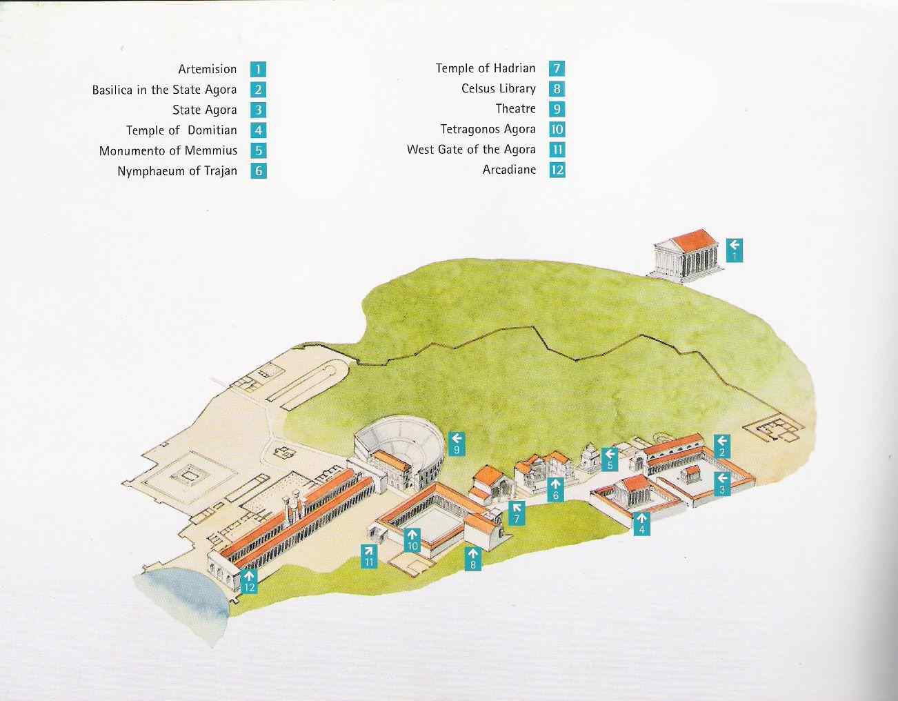
The site drapes over a saddle between two hills. From the upper gate, the route runs past the Odeon and the State Agora, then plunges down Curetes Street — the monument-lined marble spine — to the Library of Celsus at the bottom of the slope. There the city turns: the Commercial Agora opens to the west, the Terrace Houses climb to the east, and Marble Street leads north past the Grand Theater toward Arcadian Street, the grand colonnaded avenue that once ran to the harbor.
The local walking strategy
Enter at the upper gate, exit at the lower one, and let gravity do the work — the entire visit flows downhill. This is exactly how our tours run it, with the vehicle repositioned to meet you at the exit. Reverse it (as unguided visitors often must, to return to their parked car) and you climb the same distance in the sun, twice. Of all the small advantages of a private tour, this one earns the most gratitude by early afternoon.
Want the map with a voice? Every monument on it has twenty minutes of stories, and our guides know which twenty matter to you.
Sources & further reading
- UNESCO World Heritage Centre: Ephesus — official maps and documentation of the property
- Austrian Academy of Sciences — the institute mapping Ephesus since 1895